GFM: automatic global mapping
It processes all incoming Sentinel-1 radar imagery in near real time and maps the water extent with three independent algorithms, no activation needed.
Sentinel-1 · 3 independent algorithms
Which of your assets sit in a flood-prone area, when will the flood arrive, and what actually flooded? Three operational European services answer those three questions. We build the system that joins them over your portfolio.
GFM (Sentinel-1, automatic) · EFAS up to 10 days · CEMS
Before, during, and after the water: three public European services, each one at its moment.
It processes all incoming Sentinel-1 radar imagery in near real time and maps the water extent with three independent algorithms, no activation needed.
Sentinel-1 · 3 independent algorithms
The first operational hydrological network in Europe, born at the JRC and operational since 2012: warnings and forecasts up to 10 days ahead.
operational since 2012 · up to 10 days
For the 2024 Valencia floods it quantified more than 53,000 hectares affected within 48 hours, with more than 190,000 people and 3,200 km of roads potentially affected.
2024 event: >53,000 ha in 48 h
A system over your asset portfolio or your municipality: exposure(which parcels, buildings, or road sections sit in flood-prone areas),early warning (an alert when the forecast points at your assets), andverification: the real water extent mapped by radar after the event, crossed with your policies or inventory through an API or MCP.
One important caveat: in the 2024 Valencia floods, the mass claims work of Spain's public insurance consortium (CCS) relied on photos and GIS, not satellite; its satellite precedent is La Palma 2021, where it crossed satellite, drone, and cadastre data. The gap between what the data already allows and what was used is exactly where we work.
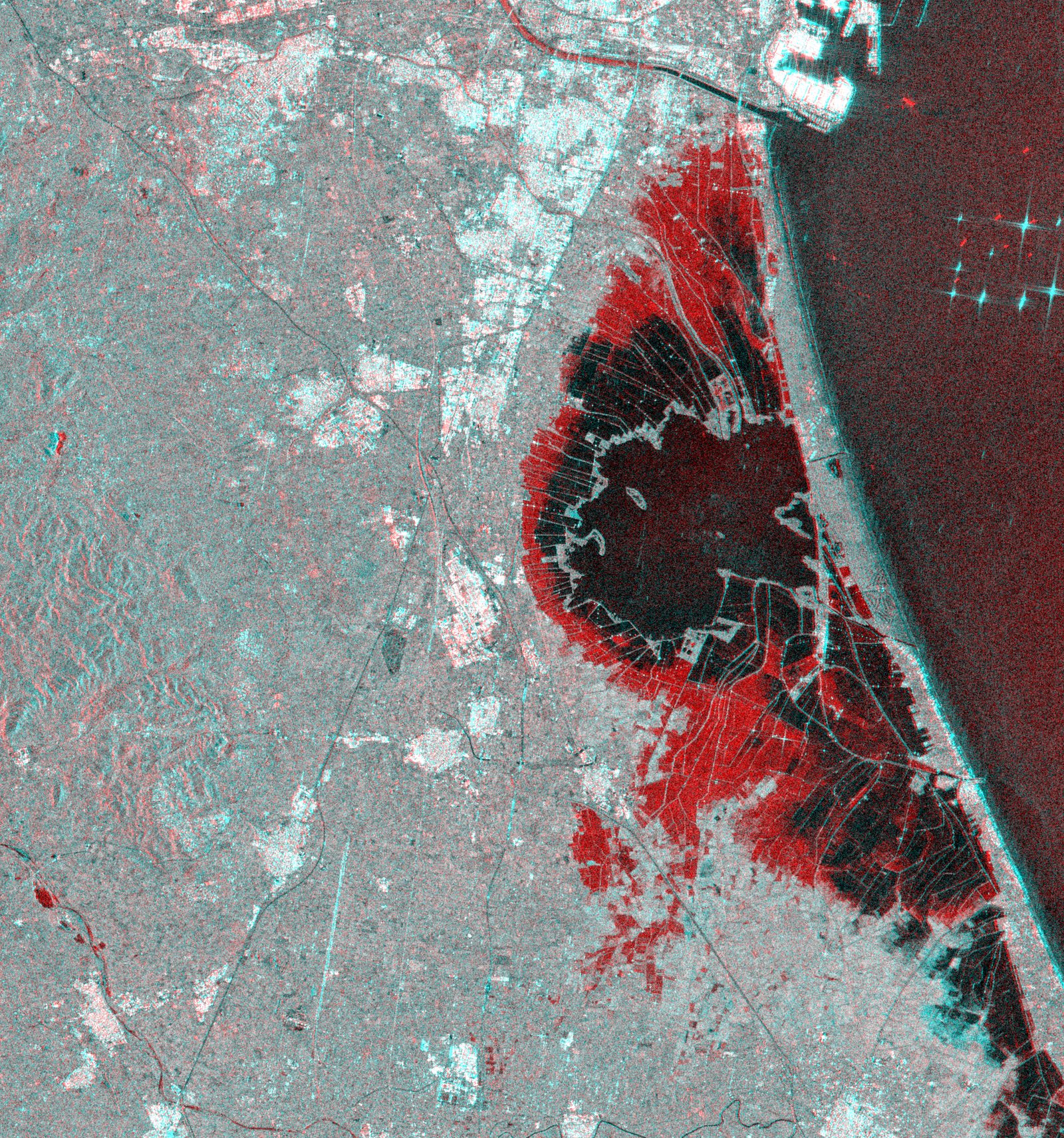
When Sentinel-1 passes over, the radar satellite that sees at night and through clouds, we compare its new scene with the earlier one: where the signal changes, there is new water. That gives you a map of the flooded area while the sky is still covered, with no need to wait for it to clear. So you see what truly flooded, not just what could flood.
Sentinel-1 · SAR radar · water extent in hours
We cross that water extent with your cadastre or portfolio: parcels, buildings, road sections, policies. The system returns which assets went under water and ranks them by importance, so you handle what matters most first. You move from a map to an actionable list inside your own system.
cadastre and portfolio · match by asset
EFAS combines forecast rainfall with a hydrological model of Europe's river basins and estimates when and how much the flow may rise. When the forecast points at your assets, the alert fires with days to spare. You gain time to protect, close off access, or warn people before the water arrives.
EFAS · flood forecast · up to 10 days
Send us your portfolio or your municipality. We will come back with the approach: exposure, warning, and verification on operational European services.
Talk to the team