We turn satellite data into decisions
Artificial intelligence, Earth observation and high-accuracy GNSS: we build the software that turns open data from space programs (Copernicus, Galileo, Landsat) into applications and decision systems made for your company.
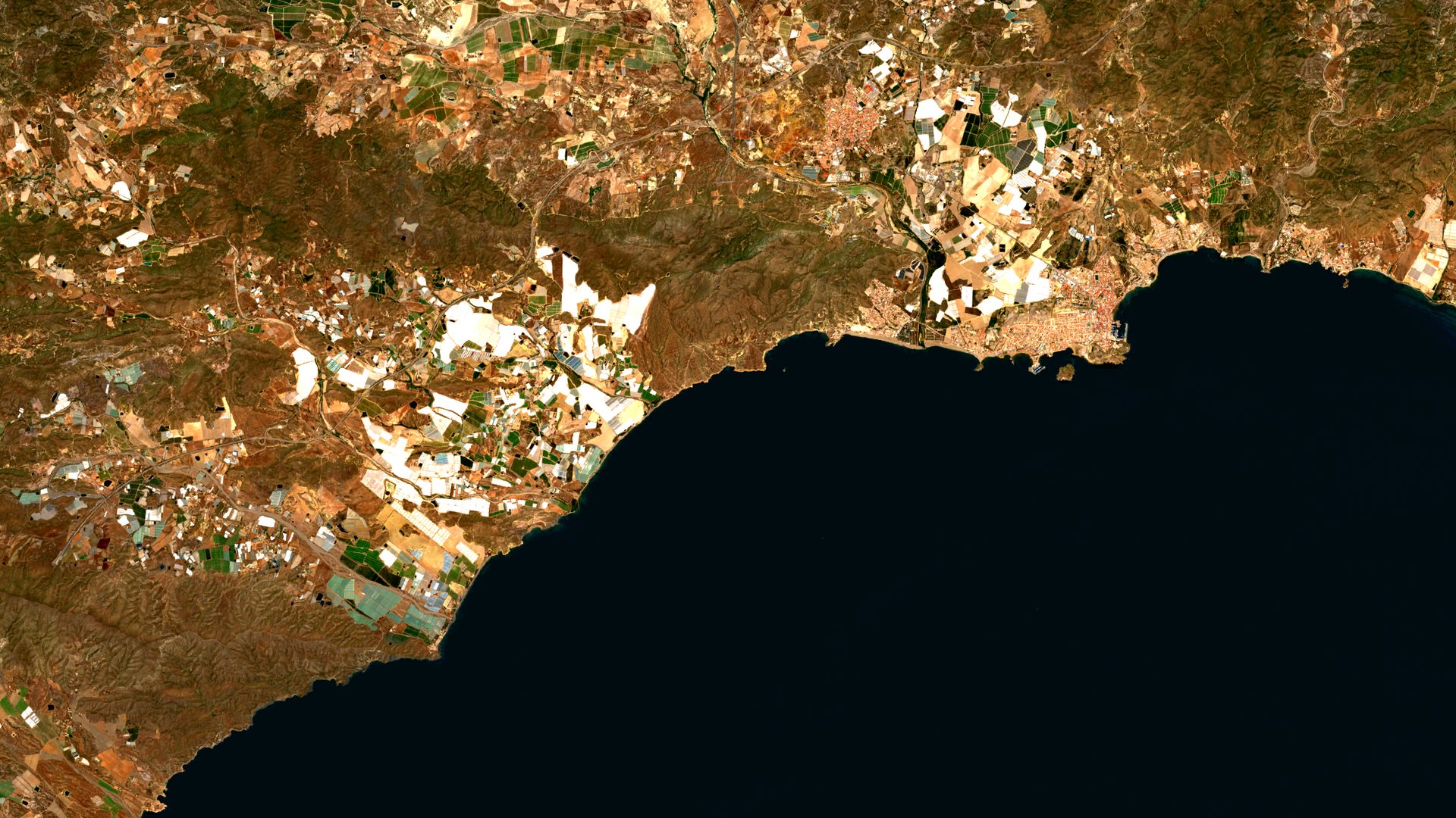
Sentinel-2 L2A · 29-05-2026 · Mazarrón Bay (Spain) · true color · 0.0 % clouds
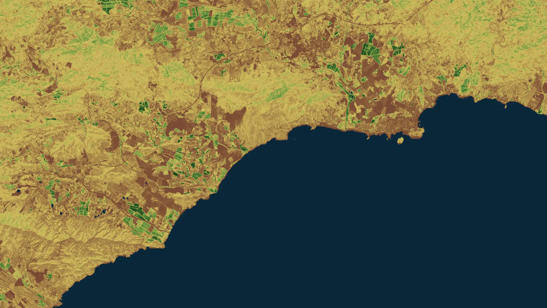
analytic layer: vegetation index (NDVI) · same scene · in-house processing
Contains modified Copernicus Sentinel data [2026] · in-house processing
6 days
Sentinel-1 radar revisit (1C+1D constellation)
10 m · 5 days
Sentinel-2 optical resolution and revisit
mm/year
ground motion precision with EGMS (InSAR)
30 min
atmospheric soundings from Meteosat Third Generation
20 cm
Galileo HAS target, free and global (Initial Service)
1940 → today
ERA5 climate reanalysis, hourly and open
figures from public European sources
What we build
Fully integrated, personalized solutions: from research and prototype to deployment and operation.
Applied artificial intelligence
Multimodal vision, AI agents, and custom models that work with your real data, from pilot to production.
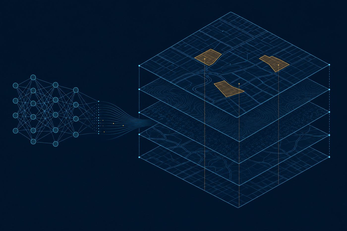
Illustration: models read layers of land data.
Earth observation
Sentinel, Landsat, Meteosat, and other public constellations: operational monitoring of land, sea, and atmosphere.
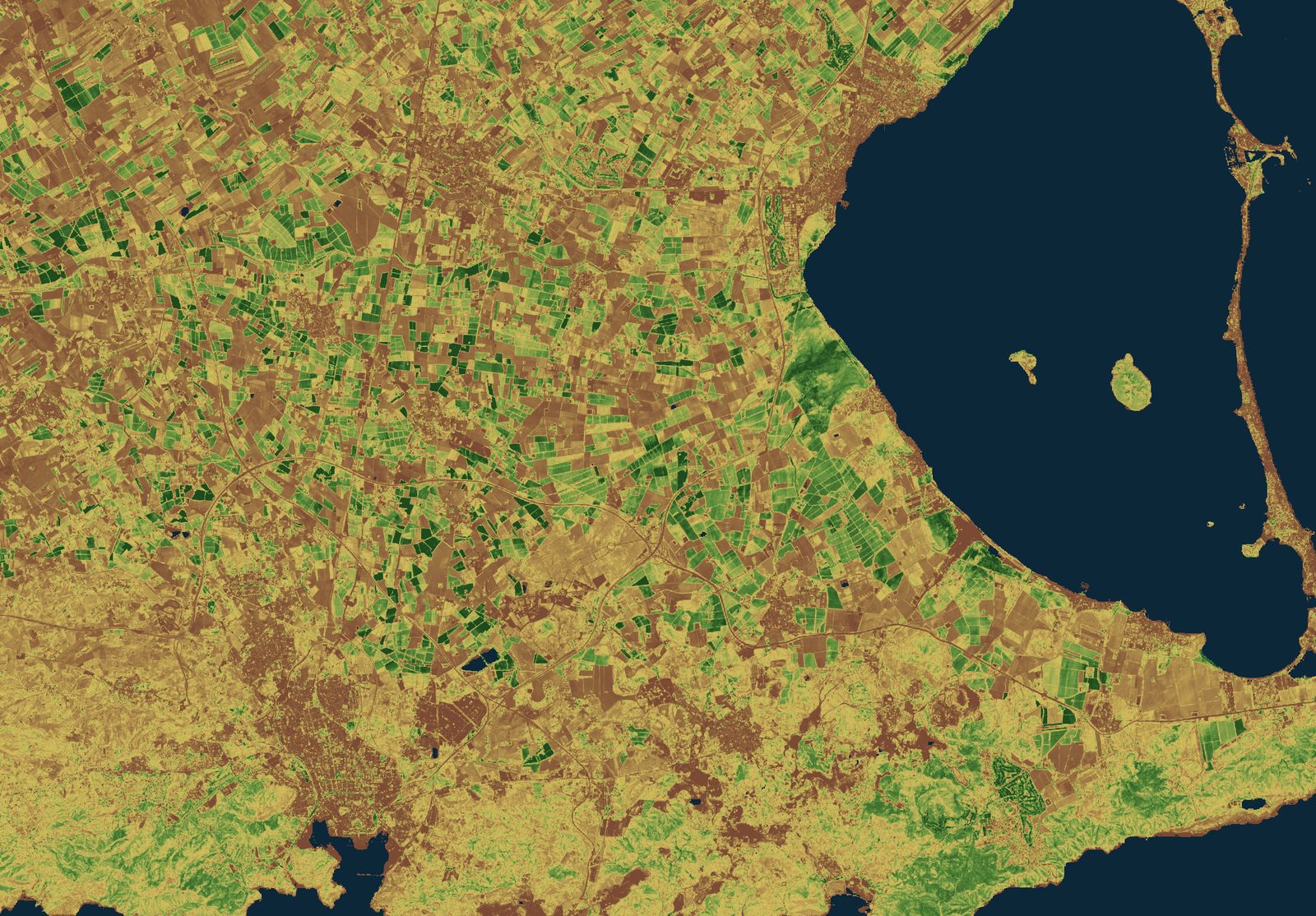
NDVI · Sentinel-2 L2A · 29-05-2026 · Cartagena farmland · in-house processing
High-accuracy GNSS
Galileo (including HAS), GPS, and EGNOS integrated into your machines, your fleet, or your field app.
Galileo HAS · OSNMA · EGNOS
Decision support systems
DSS that combine satellite data, sensors, and your own sources through APIs and MCP, and answer with clear recommendations.
satellite + sensors + your data
For your sector
Space agencies and public bodies document hundreds of applications that most companies do not use yet. We turn them into practical tools for your business.
From data to the screen that decides
Our solutions end in a system someone uses every day. Here is what one looks like inside: data comes in on one side, and recommendations, alerts, and reports come out the other.
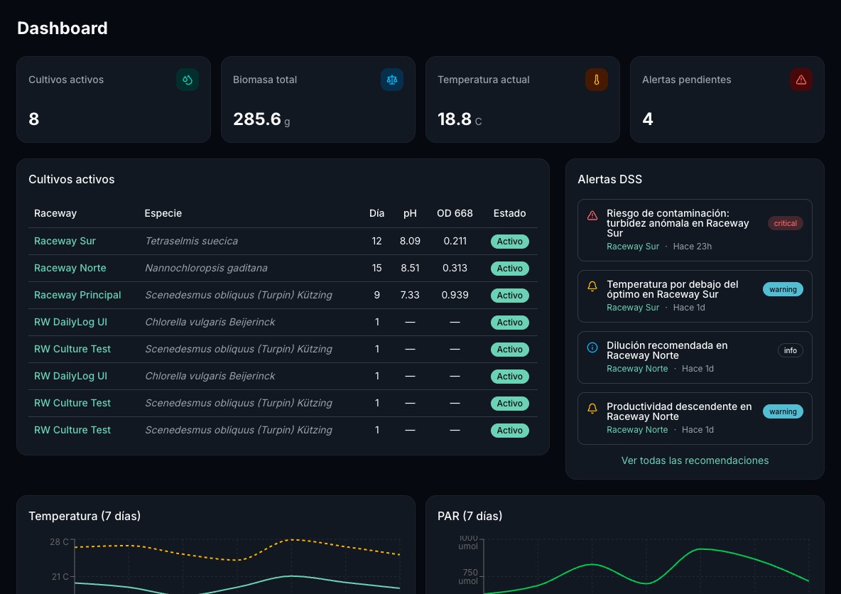
IN
Satellite, field sensors, your systems through APIs and MCP, and weather, merged into a single view with its history.
OUT
A recommendation with its evidence, an alert that fires on its own when a threshold is crossed, and a report that records every decision.
Also in the Americas
The same systems, on open data from NASA, NOAA, USGS, and USDA and from Latin American agencies, together with European data, which is also global and free.
Systems already in operation
These are the four most recent projects in a longer track record of the team that today forms T3 AISAT, within European and national R&D programs:
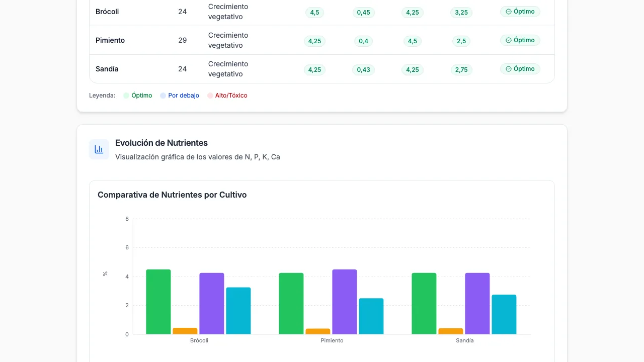
TELENITRO
Real-time nitrogen management DSS for Mediterranean horticulture (PRIMA program).
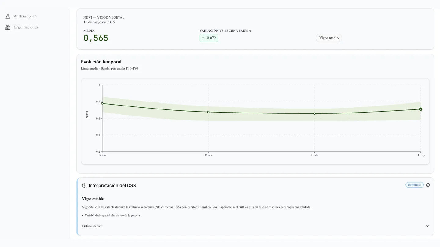
LINOMAR
Crop and microalgae production DSS for biostimulants (EAFRD, Mar Menor and La Albufera).
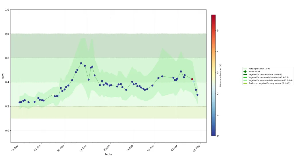
Olive Carbon Balance
Remote sensing studies and carbon balance DSS for olive groves (Spanish operational group).
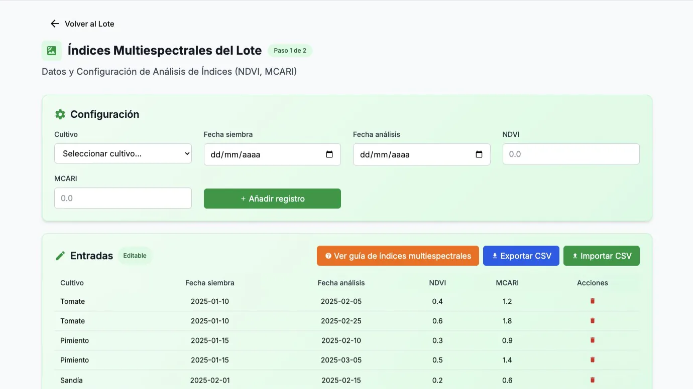
MICROMAR
DSS and satellite monitoring of vegetable crops with biostimulants (Biodiversity Foundation).
real screenshots from each system's manual · demo data
Android and iOS · free download
T3 AI SAT, the app that gave us our name
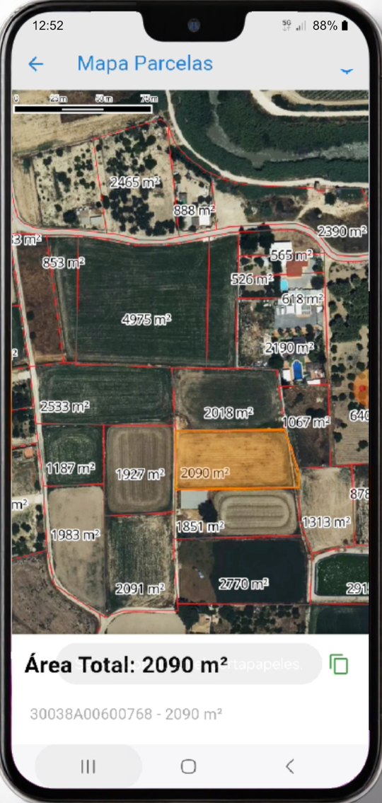
A camera that writes the date, the coordinates and the street address inside the photo itself, and the Spanish cadastre drawn over satellite imagery. The same thing we do at regional scale, in the pocket of whoever walks the field.
Loss adjusters, field technicians and environmental professionals use it to document where they stood without anyone having to take their word for it.
Which decision would improve your operation?
Tell us. We will show you which data and which system can answer it.
Talk to the team