CleanSeaNet (EMSA)
The European satellite service for oil spill and vessel detection: SAR radar, day and night, independent of clouds, with near real-time alerts to coastal states.
>3,000 images/year · since 2007
Who watches your waters when there is no light and no visibility? Radar sees at night and through clouds. We build custom monitoring for your port, concession, or stretch of coast, complementary to Europe's institutional service.
Sentinel-1 SAR · day and night · CleanSeaNet operational since 2007
A mature European service sets the standard; open data makes it possible to complement it.
The European satellite service for oil spill and vessel detection: SAR radar, day and night, independent of clouds, with near real-time alerts to coastal states.
>3,000 images/year · since 2007
CleanSeaNet serves states, not companies. That is the gap: complementary monitoring on open Sentinel-1 data for those who operate the water every day.
institutional access · a B2B gap
Operational currents from Copernicus Marine feed drift models used in search and rescue and in pollution response: where a detected spill will go.
CMEMS · drift forecasting
For ports, terminals, and operators: recurring radar monitoring of your area with Sentinel-1; AI-assisted detection of possible spills; drift forecasting with Copernicus Marine currents to anticipate where it will arrive; and an evidence log per scene for your environmental management, served through an API or MCP. If you are an administration, we work as your integrator: the response DSS that joins what CleanSeaNet sends you with your assets and protocols.
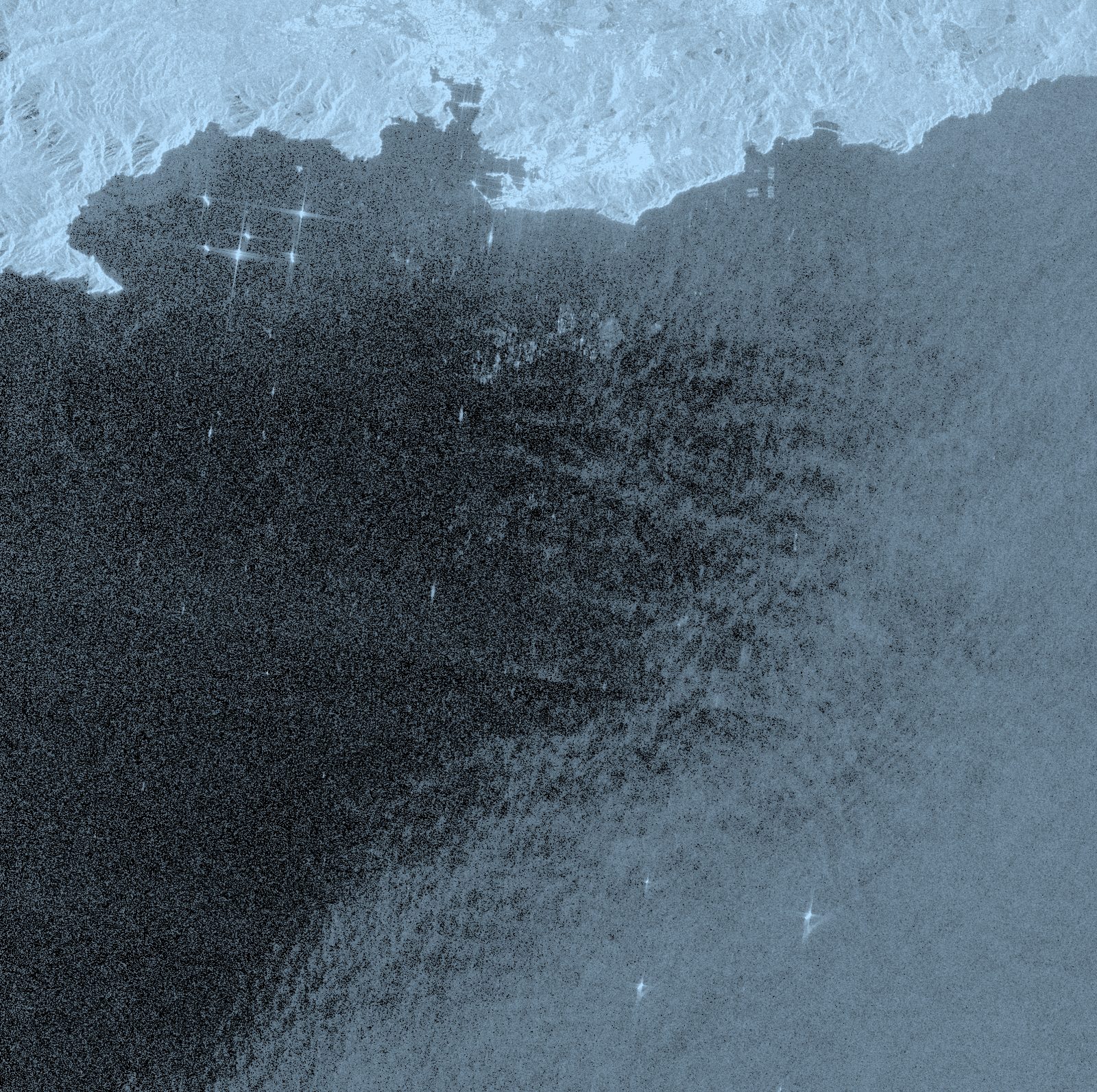
Sentinel-1 SAR radar sees the sea at night and through clouds. Oil smooths the waves, so that patch reflects less signal and shows up as a dark slick on the rougher sea. The system flags it, draws its shape and extent, and separates it from normal waves. You get the alert that something may be there, with its outline.
Sentinel-1 SAR · detection day and night
With sea currents from Copernicus Marine, the system works out where and how fast the slick will move in the coming hours. You cross that path with your coast, your beaches, or your fish farm and see what may be affected and when. You move from knowing something is there to knowing where it is heading.
Copernicus Marine · drift forecast
Every detection produces a report: the scene time, the radar image, the coordinates, the shape of the slick, and its forecast track. It is an evidence log per scene for your environmental management or to notify the competent authority. Every scene stays identified and traceable.
report per scene · time, image, and track
Tell us your area (port, concession, coastal stretch) and we will propose the radar watch that fits your means.
Talk to the team